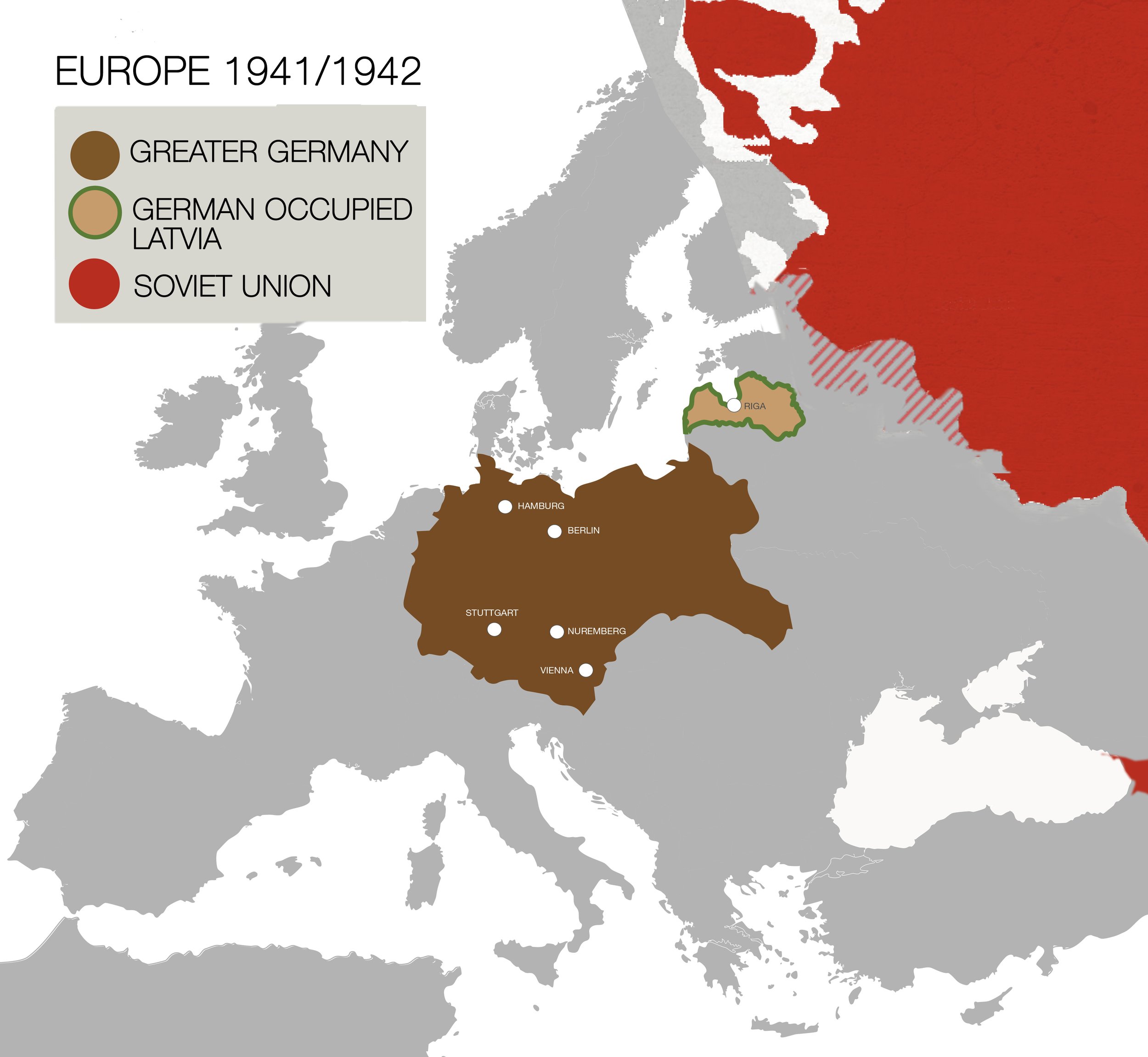
1941/1942 map situates Latvia within a German dominated Europe, highlighting the recent German occupation of Latvia. The Soviet Union is included as a prior occupier of Latvia between 1940-1941. This map notes a Soviet winter-offensive taking place in 1941/1942 (see shaded area). The Soviet Union remained a menacing presence in the region, reoccupying Latvia from 1945-1991.
The five deporting cities: Berlin, Nuremberg, Stuttgart, Vienna, and Hamburg are indicated on the map. Transports traveled for three days and nights, without food or water, to arrive at the Skirotava train station in Riga, Prisoners were forced to march 4 kilometers in bitter cold temperatures to the Jungfernhof concentration camp..
Zoomed out map of Latvia
Zoomed in map of area once
occupied by Jungfernhof Concentration Camp
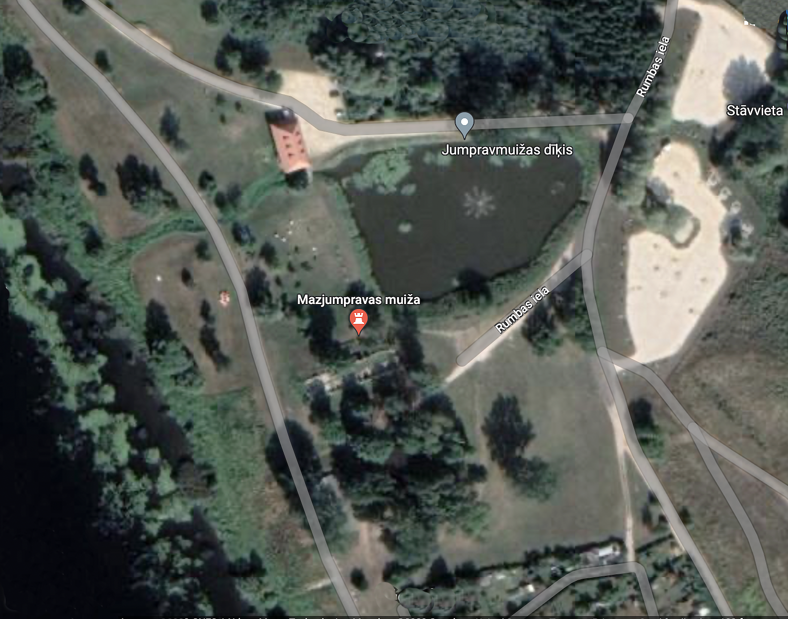
This map features an aerial view of the site once occupied by the Jungfernhof concentration camp. Ruins from the Mazjumprava Manor are visible within a new public park designated for leisure and relaxation. Two large parking lots are recent additions.
Remotely situated, the camp was without barbed wire fencing. Prisoners were confined to the camp by an armed border patrol. There are no physical markers remaining that indicate the precise parameters of the camp.
Satellite image taken from Google maps (2023)
Jungfernhof Aerial View

1917 German Army aerial photo, Baden-Wuerttenberg Land Archives. https://bit.lv/3j3FsEI Retrieved by Ilya Lensky (2020)
The only historic map of the area found in the archives, is from a WWI reconnaissance mission. That map presents the layout of land that includes the manor estate, a warehouse, and a cluster of barns and sheds.
Archival Maps
Maps of Jungfernhof drawn by Rudolf Seck, SS Kommandant of Jungfernhof, for his trial. Retrieved from Hamburg archives.

Map of murder. In January 1942, Seck shot five elderly male prisoners by the side of a barn. Their crime was to warm themselves in front of a fire. The map was drawn by an eyewitness to the crime. Seck forced her to watch the killings. The map was used as testimony in Seck’s trial and aided in his conviction. Retrieved from Hamburg archives.

